Geoscience Virtual Labs During CV-19 Using 3-D Photogrammetry
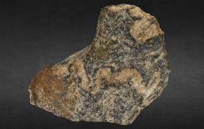
3-D photogrammetry model of a migmatite sample from the metamorphic rock lab.
September 27, 2020
Teaching geoscience labs can be challenging during the CV-19 pandemic not only because of social distancing guidelines, but also because some labs (e.g., minerals and rocks) have a limited number of specimens that all students must touch and study.
Scott Wilkerson, with the help of Beth Wilkerson (GIS specialist in the FITS GIS Center), has developed a unique and innovative way to allow students to interact with GEOS 110: Earth & the Environment mineral and rock specimens virtually.
The interactive 3-D models of the actual lab samples were created using an ordinary camera and Agisoft Metashape Pro 3-D photogrammetry software. Using from 72 to 144 overlapping photos for each specimen, the software calculates the detailed topography of the sample using stereographic techniques and then overlays that 3-D geometry with a composite photographic texture of the object's surface. The 3-D model is then imported into SketchFab, which creates the interactive environment that can be embedded onto a web page or an ArcGIS story map. Videos can also be included using video from an iPhone 11 that is then exported into HandBrake video compression software where it is converted to MP4 format for inclusion into the story map.
Scott is currently using the Minerals lab (see below) for his Fall 2020 GEOS 110: Earth & the Environment lab. Students are paired up in Zoom breakout rooms and work together to identify the minerals. Initial results look promising...students are engaged and have been readily able to interpret the key characteristics for identifying the minerals. Some have even remarked that the 3-D photogrammetry models seemed almost like the real mineral sample.
Check them out and let us know what you think!
Minerals: https://arcg.is/0zTu1n
Igneous Rocks: https://arcg.is/0eejOj
Sedimentary Rocks: https://arcg.is/1f4zPq
Metamorphic Rocks: https://arcg.is/1jSn0y0