GEOS 220 Field Trip - Geology around Las Vegas, NV
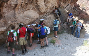
Students mapping a fault near Hoover Dam.
March 22, 2014
Dr. Jim Mills led a Spring Break field trip for the GEOS 220 course to study the geology of various areas around Las Vegas, NV, including studying Basin & Range deformation in Death Valley and mapping some of the volcanic units surrounding Hoover Dam and Lake Mead. Prior to the trip, students learned about the tectonics and rocks present in the field area and created some preliminary maps in Google Earth. After the trip, students will refine their geologic maps, create cross sections of the map area, and write a professional geologic report describing the geology of the entire region.